Mapping line features in Geolantis.360 mobile app using My Position GPS mode requires feature class configuration of the feature class called ‘Locator’.
During data collection, Geolantis mobile field app will automatically create Locator points along with the nodes of the line being mapped.When Geolantis connects to utility locating equipment, the Locator points will hold attributes such as depth value of underground features as well as sensor data.
Define higher categories of the Locator feature class as follows:
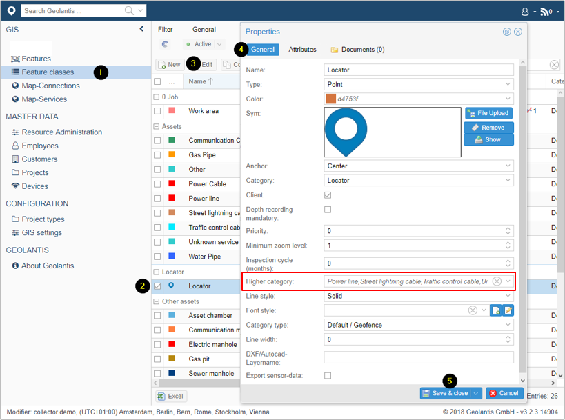
- Go to the Feature Classes page
- Select Locator feature class
- Click on Edit to configure feature class
- Select the required line feature class for mapping as a higher category
- Save and close the feature class properties window
In the mobile field app, start adding features in My Position (GPS) mode or Record Manually as follows:
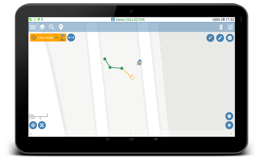
- Click on the Place button
 to start mapping.
 - Select feature class with line feature type.
- Click on the activated Place button
 to create a new point. Geolantis field app will automatically create Locator points along with the nodes of the line being mapped.
 - To continue mapping, start walking while collecting data in the My position (GPS) mode, or select other location on the map for Record Manually mode and place new points.
- Click on the Done button
 to save and sync the collected features or click on the Cancel button to abort the mapping.
 - Optional: Activate the Distance Auto Recording for automatic continuous line mapping in My Position (GPS) mode.
- After data synchronization is completed, the created features can be viewed and exported from the Features page at Geolantis.360 web portal.