This article demonstrates how Geolantis.360 can be used to collect spatial and attribute data, manage a workforce and be the central workforce management platform for a facility management project. By using the Geolantis.360 web portal and the mobile field app we can manage our field team movements as follows:
- Create repeatable field inspection processes of facility utilities,
- Track the location and status of facility utilities,
- Map the GPS position of survey sites and document location information,
- Document and control the quality of site inspection visits with photos, up-to-date drawings, and custom attributes as per the targeted database,
- Enforce real-time data synchronization between field workers and office administrators at each step.
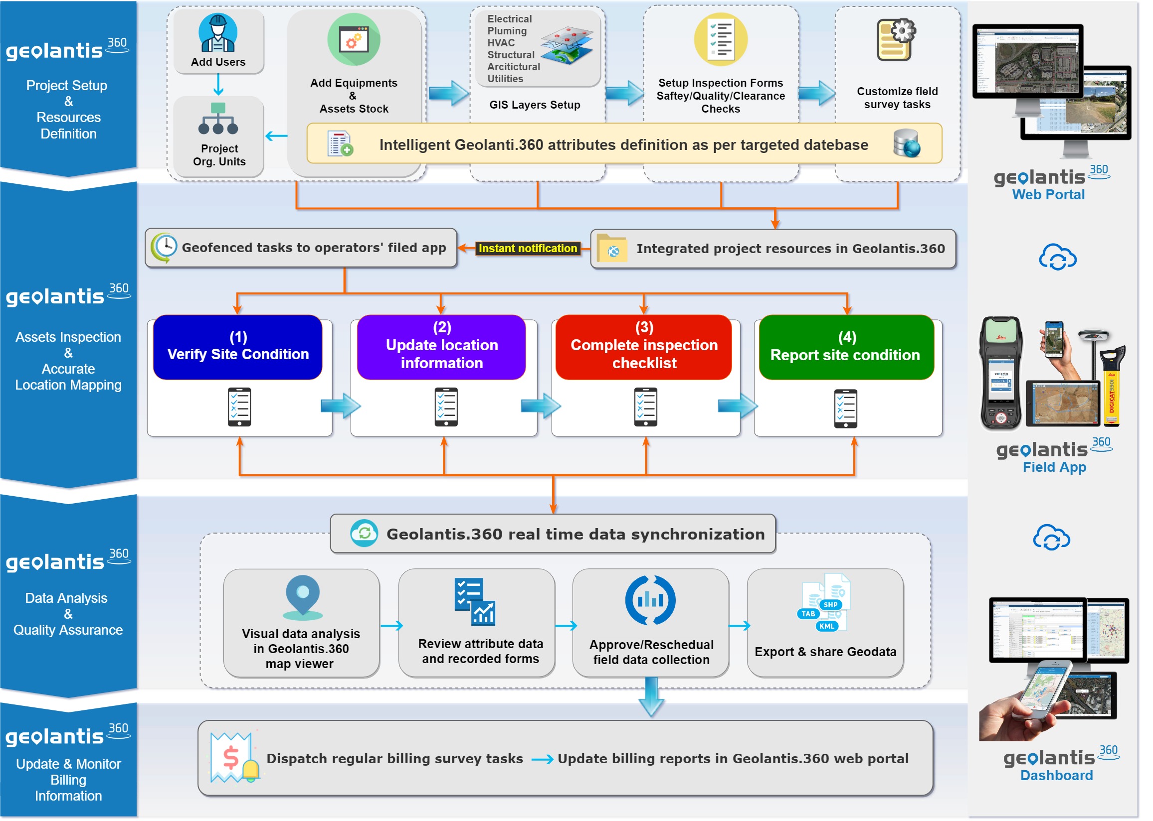
The facility management workflow with Geolantis.360 encompasses four main phases:
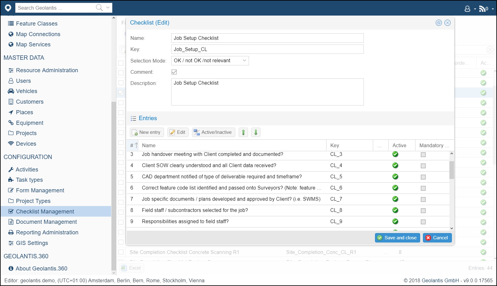
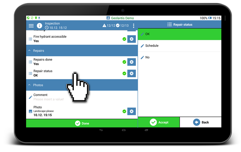
- Site inspection using smart forms that include custom attributes as per the targeted database.
- Accurate mapping of inspection position.
- Location tracking of frequent maintenance orders and data collection.
- Monitoring and reporting billing information based on consistent data collection.
How to manage the facility inspection process with Geolantis.360?
Use Geolantis.360 web portal to assign tasks to the field workers and manage their movements. Geolantis.360 enables project managers to assign tasks that force a prescribed process, such as field visits to facility sites and detailed data collection.
To manage all field workers and control their operation movements, start by storing all field workers in the Users page, and distribute them in organizational structure and that cover all targeted inspection area by city, district, or residential block.
Once the user setup and structure is complete, we can assign field workers to certain work areas (geofence work boundary) and tasks as follows:
- Go to the Features page.
- Select project.
- Click on New Feature to draw a work area.
- Create a work area polygon
- Add the work area to a New Task.
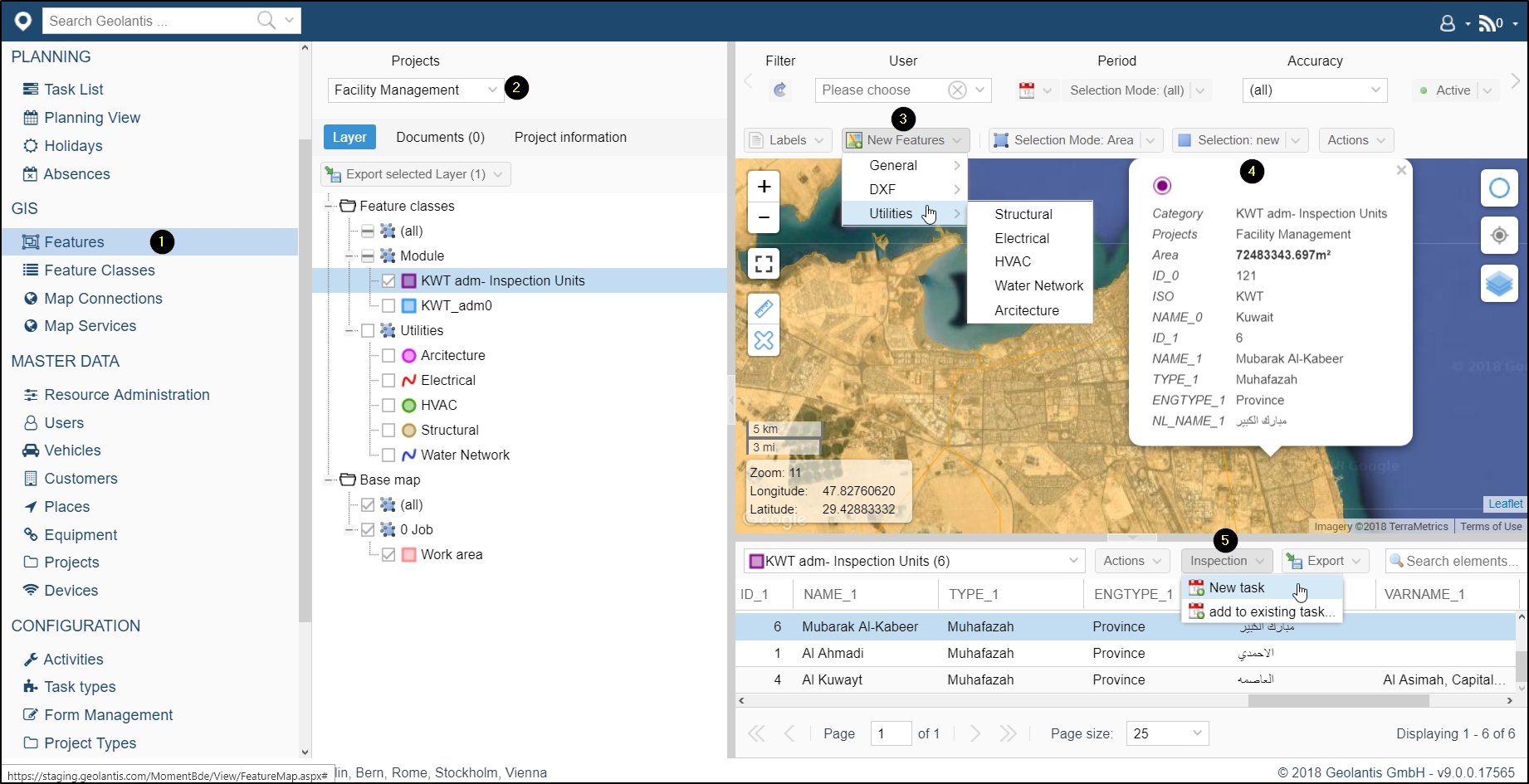
In the New Task screen, schedule and dispatch the task to a field worker.
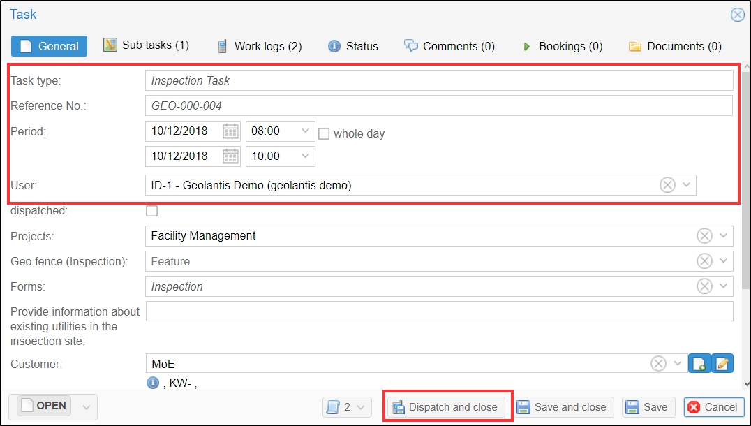
In Geolantis.360 field app the workers receive their assigned tasks, in this case, document the inspection site current status, and complete the task within their designated work area.
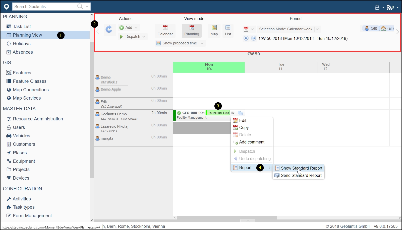
Project managers or task supervisors can simultaneously monitor and control the quality of the facility inspection tasks and the recorded utility attributes through Geolantis.360 web portal.
- Go to the Planning View page.
- Filter tasks by date and/or worker.
- Select a task and right click.
- Review and share reports of recorded inspection forms by the field worker.
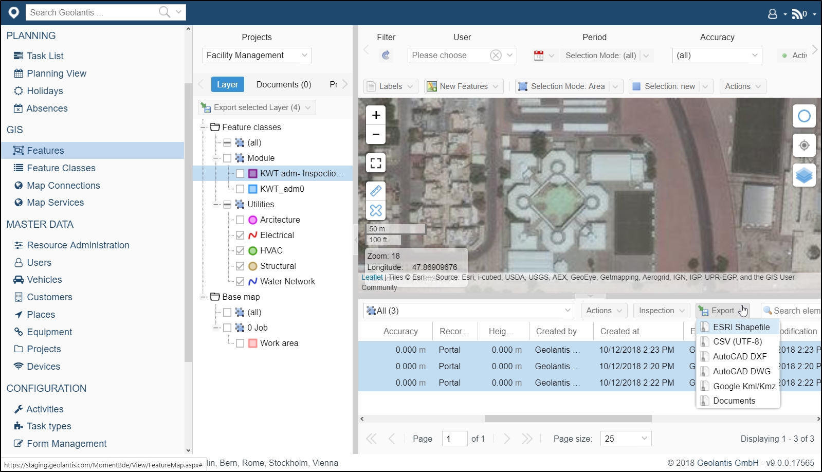
After the data collection is completed by the field workers, review and export all submitted information to a variety of standard geo-data formats. Geolantis.360 provides an advanced GIS viewer to analyze collected spatial as well as attribute data. Use the Features page in Geolantis.360 web portal to visualize, edit, and export data to other GIS systems.
With all recorded data synchronized in real-time, site inspections using Geolantis.360 web portal and field app can lead to optimizing cost estimates for required site maintenance and provide all necessary proof documents and photos from inspection sites. Geolantis.360 also reduces site inspection operational costs to the minimum and ensures consistent data collection through designated Geolantis.360 smart forms and checklists per task.