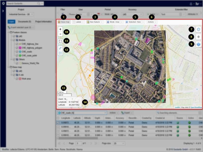
| 1. Turn on/off base map layers |
| 2. Turn on/off XY labels. Select name, vertices, or coordinates to be displayed as feature label |
| 3. Create new features |
| 4. Choose between the area or single selection mode to show features within a selected area. Use the mouse to draw the selection area. Choose information to disable selection mode |
| 5. Use the selection control to create new, add to existing, or remove existing selection |
| 6. Define selection action. Choose between clear or inverse selection |
| 7. Change background brightness |
| 8. Move to actual GPS location (browser must be enabled to access GPS location) |
| 9. Switch between multiple background views |
| 10. Zoom in / zoom out controls |
| 11. Enlarge map size |
| 12. Distance measurement tool |
| 13. Map scale bar |
| 14. Zoom level and coordinates of the current view |