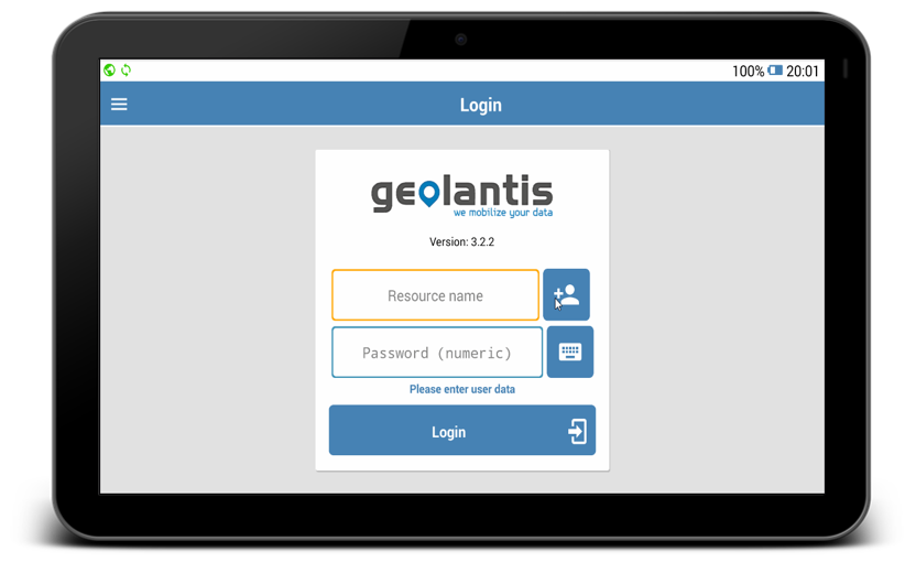
Start Geolantis app on your Android device and log in using your credentials
- Enter username
- Enter password
- Click Login∗
Mobile Field App Out of the Box
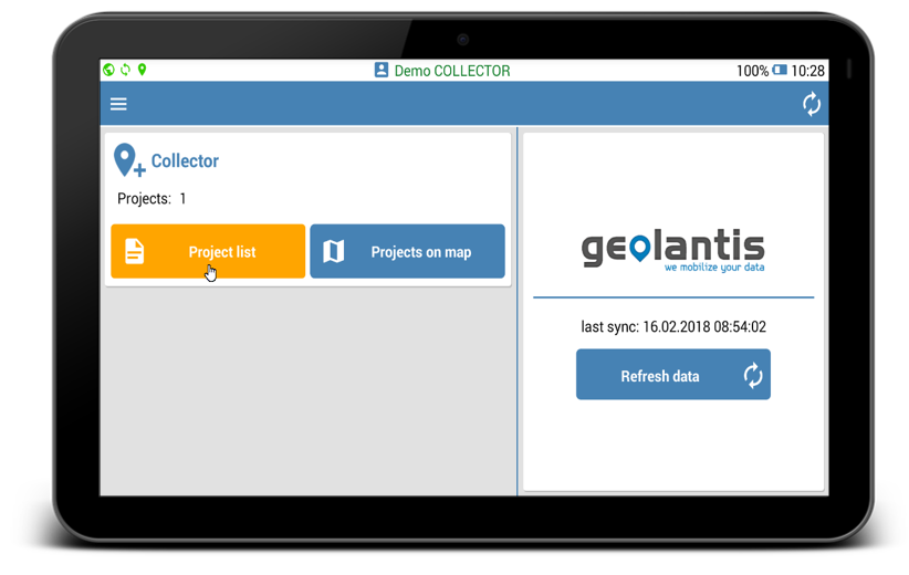
Users with Geolantis.COLLECTOR subscription have access to the Collector module in Geolantis mobile field app.
Use the Collector module to start data collection in your field mapping project∗
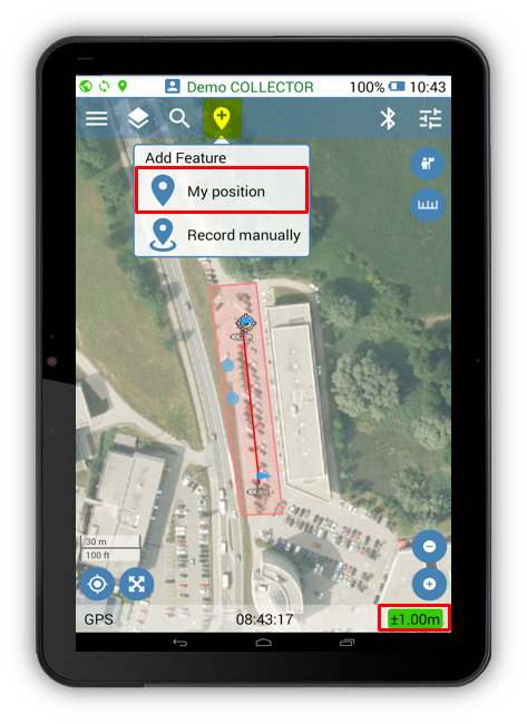
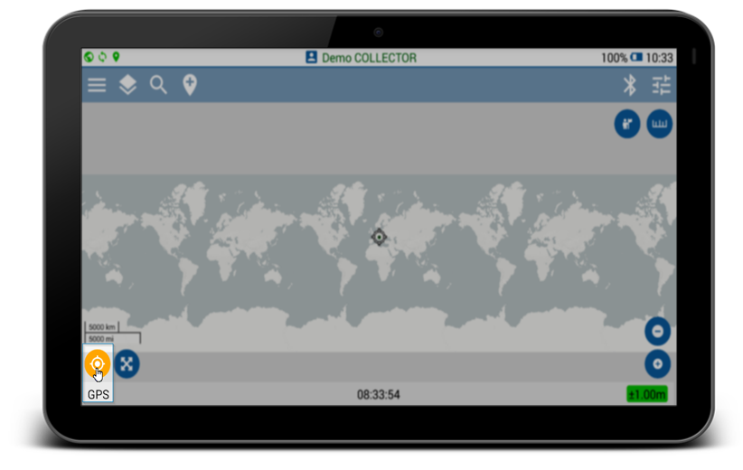
1.Open Project list
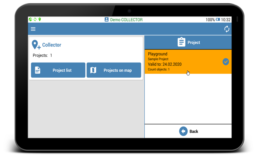
2.Select project
3.Move to your current GPS location
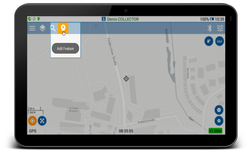
4.Click Add feature icon
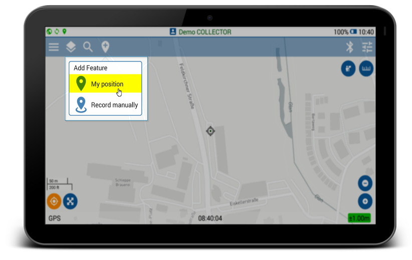
5.Select “My Position”
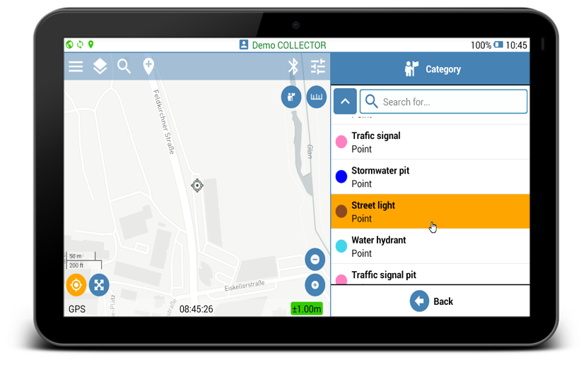
6.Select feature class to map
Mapping screen
Press and hold any button to see the function description. Read the Golantis.360 Mobile Interface user guide for more details.
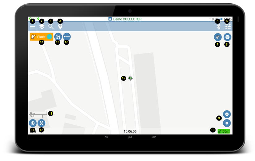
| 1. Access side menu |
| 2.View project layers |
| 3. Search feature category |
| 4. Start data collection |
| 5. Connected Bluetooth devices |
| 6. Configure map settings |
| 7. Create new point/node |
| 8. Finish data collection |
| 9. Zoom controls |
| 10. GPS accuracy |
| 11. Move to current GPS position |
| 12. View full extent of projects features |
| 13. Map scale bar |
| 14. Active feature class for mapping |
| 15. Place multiple points or polygon nodes |
| 16. Activate distance auto recording |
| 17. Current GPS position on the map |
Create New Features
Mapping new features in Geolantis.360 mobile app can be done based on user‘s actual GPS position, or manual recording from any defined location on the map.
Start mapping in My Position mode as follows:
- Add new feature to your mapping project by clicking the Place button
 and select feature class.
 - Click the bold Place button
 to create new point/node and start walking to continue mapping.
 - Click the Done button
 to save and sync the recorded features or click the cancel button to abort the mapping.
 - GPS accuracy indicator must be green for high accuracy, or orange for medium GPS accuracy. Red GPS indicator will not allow features recording when GPS accuracy is low.
- After data syncing is completed, the created features can be viewed and exported from the Features page at Geolantis.360 web portal.