The Distance tool can be used to distance between user‘s actual GPS position and other location on the map
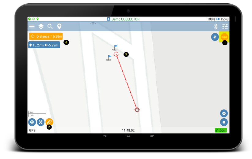
- Enable Distance measurement tool
- Activate the Linked Objects tool to force the measurement line to start from the current GPS cursor position
- Move the two sides of the distance measurement line to the desired locations. Distance value appears on the top left of the mapping screen. The distance information shows also a vertical and horizontal difference between user‘s actual GPS position and the selected location on the map