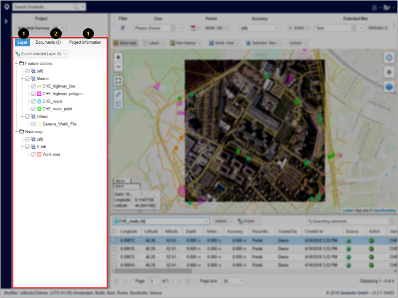
The Features page in Geolantis.360 shows the project content in the following structure:
1. Layers Tab
- Project content will be divided into „Feature classes“ and „Base Map“ lists if the project contains at least one feature class that is configured as a base map.
- The „Layers“ tab shows a tree of project feature class categories.
- Select individual, multiple, or all feature classes to display their content on the map section.
- Content of selected feature classes can be exported to variety of CAD/GIS formats. Select feature classes and click the „Export“ button
 at the top left of the „Layers Tab“
 - Use the mouse right click to export single feature class, and to zoom the map to the features extent of the particular feature class.
2. Documents Tab
List of documents attached to the project, that can be exported in a zipped folder.
3. Project Information Tab
Project description and other relevant details.