The Distance tool can be used to measure the distance between two different points in the mapping screen.
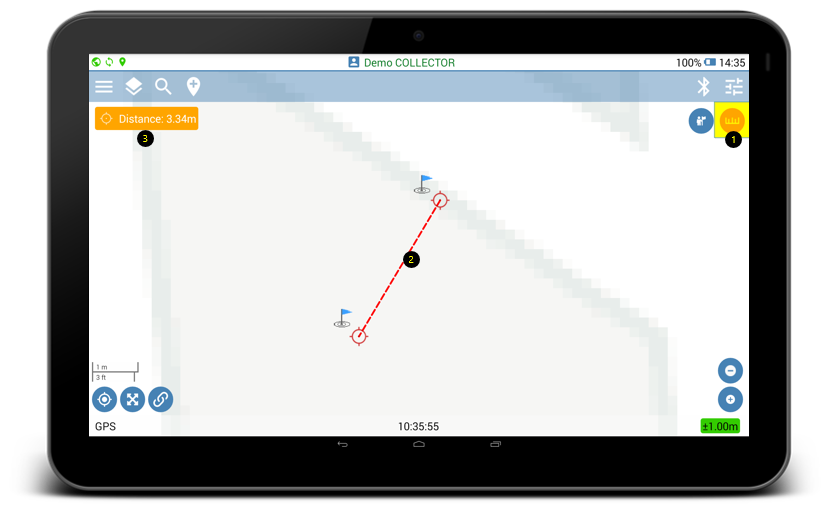
- Enable Distance measurement tool.
- Move the two sides of the distance measurement line to the desired locations.
- Distance value appears on the top left of the mapping screen. Depending on the GIS Settings configuration in the web portal, the distance value can be displayed in meters or feet. See below how to configure the measurement units.
How to configure measurement units?
Use GIS Settings page in the web portal of Geolantis.360 to configure measurement units.
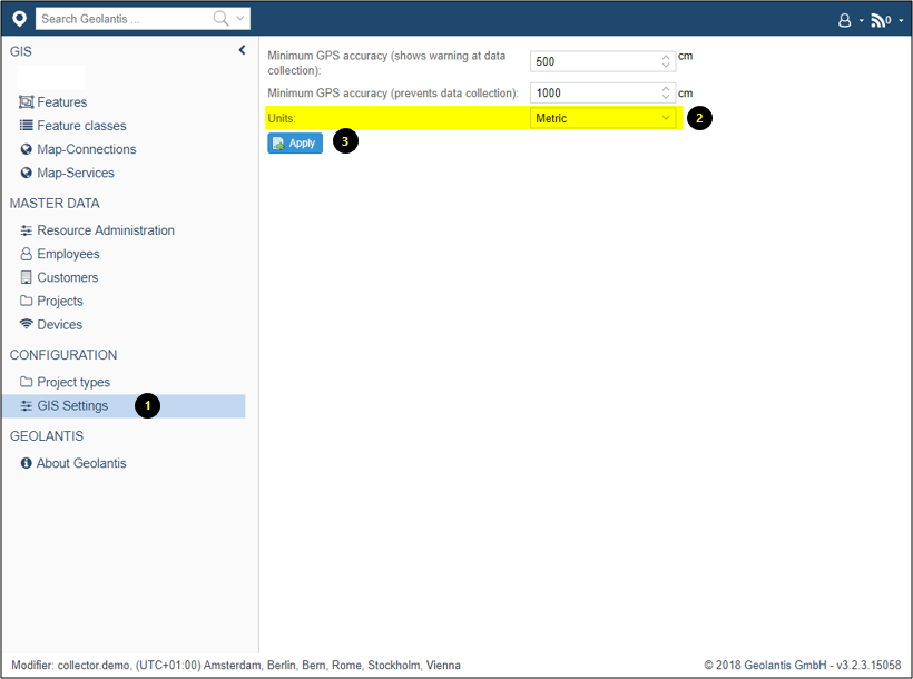
- Go to GIS Settings page
- Choose between Metric or Imperial as preferred measurement units
- Click Apply and restart Geolantis mobile field app