Mapping screen shows up after a project is opened in the collector module.
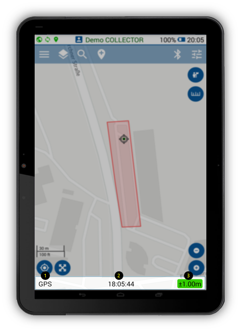
- Location service information. Click on the GPS bottom bar to display position information (X/Y/Z)
- Recording time in user‘s timezone
- GPS accuracy*
66 views Hanie 1
Mapping screen shows up after a project is opened in the collector module.