Configuring GPS Accuracy
Use GIS Settings page in the web portal of Geolantis.360 to configure GPS tolerance for mapping features by the mobile field app.
Depending on the defined minimum GPS accuracy values in the GIS Settings page, the mobile field app allows or prevents mapping new features when a certain range of GPS accuracy is exceeded.
In the mobile field app, GPS accuracy indicator must be highlighted as follows
Green: for high positional accuracy
Orange: for allowed average positional accuracy
Red: for preventing mapping features when positional accuracy is very low
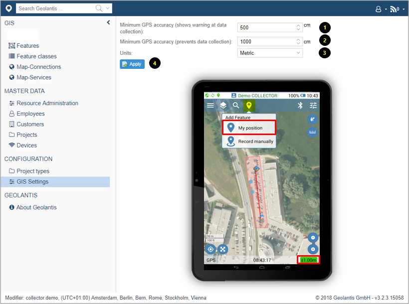
- Set the minimum GPS accuracy that allows mapping and shows warning of average GPS accuracy. In the mobile field app, the GPS indicator at the Location info bar changes to orange when this value is reached
- Set the minimum GPS accuracy that prevents mapping and shows warning of average GPS accuracy. In the mobile field app, the GPS indicator at the Location info bar changes to red when this value is reached
- Choose between Metric or Imperial as preferred measurement units
- Click Apply and restart Geolantis mobile field app