The settings button opens a list of map configuration settings.
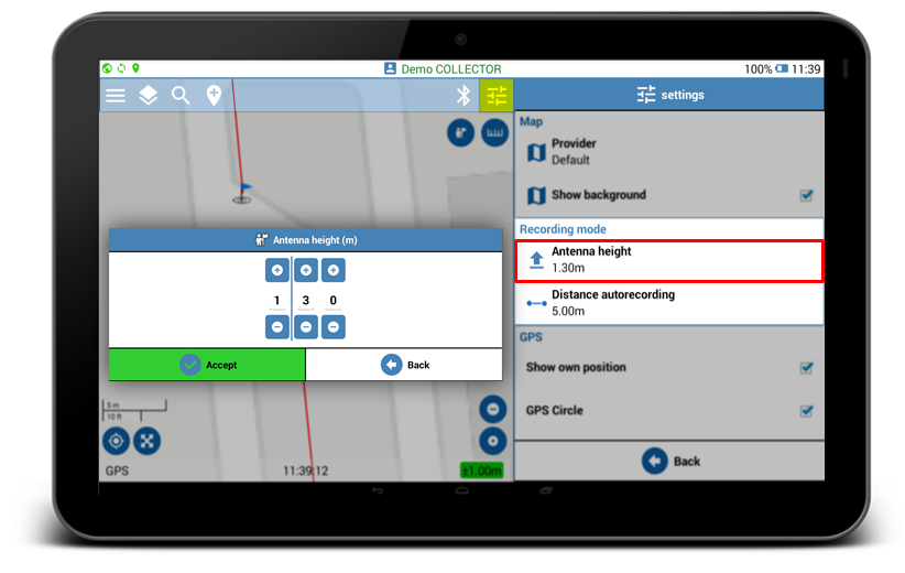
Antenna height
Specifying antenna height allows accurate data recording for mapping features on the ground.
In order to obtain precise feature altitude, Geolantis.360 automatically excludes this antenna height value from the height of the recorded features.
Click on Antenna Height in the Recording Mode settings to specify antenna height. The first digit on the left defines the height in meters, and the two digits on the right define additional antenna height in centimeters.
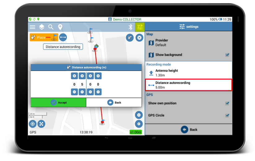
Distance auto-recording
Geolantis.360 provides the option to create new points/nodes automatically in fixed frequency when there is a need for long distance mapping.
- Click on Distance Autorecording in the Recording Mode settings to specify the length between every two points/nodes when the distance auto-recording is activated for mapping new features. The two digit on the left define distance in meters, and the two digits on the right define additional distance length in centimeters.
- Add new feature to your mapping project by clicking the place button
 and select feature class.
 - Activate the Distance Auto Recording mode
 .
. - Click the active Place button
 to create new point/node and start walking.
 - Click the Done button to save and sync the recorded features or click the Cancel button to abort the mapping.