Mapping new features in Geolantis.360 mobile app can be done based on user‘s actual GPS position, or manual recording from any defined location on the map.
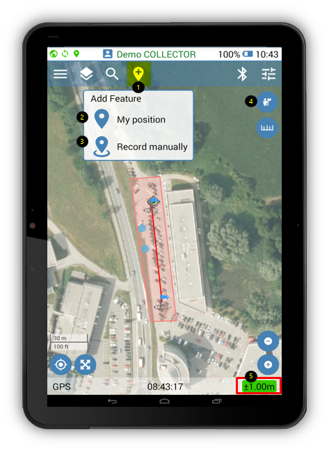
- The Add Features button can be used to create features using actual GPS position or using manual recording from any defined location on the map.
- Selecting My Position option will start feature recording at the actual GPS position. New feature/node will be created at the user‘s current position.
- Selecting Record Manually option will start the manual features recording mode. Location of the new feature should be selected manually on the map.
- Depending on the chosen Add Feature option, the Place button can be used to create new point/node either at the actual GPS position or at the defined position on the map.
- GPS accuracy indicator must be green for high accuracy, or orange for fair GPS accuracy. Red GPS indicator will not allow features recording when GPS accuracy is very low.