The attributes table in the new Features page shows records of the selected features (using filter and/or map selection controls). The selected features can be also edited and exported to variant GIS and CAD formats from the attributes table section.
Use the following options to manage features from the attributes table:
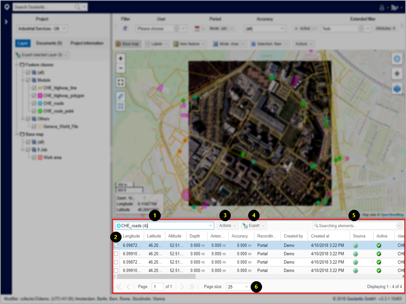
- Attributes can be listed for single or multiple feature classes. The feature class list in the Attributes Table contains feature classes if they are turned on in the project content Layers tab
- Select a single feature to edit or export using the mouse right click on the feature row
- Select an action to perform on a single selected feature. Choose between Show (zoom to), Edit, set Active/Inactive, Assign to inspection task, link to other feature, or Display GeoJSON code of a selected feature
- Export single or multiple features to variant GIS and CAD formats. Attached documents or field photos to a feature can be exported in a zipped folder from the Export list
- Use the Search bar to find specific feature
- Specify the number of features per page to be displayed in the features list within the Attributes Table