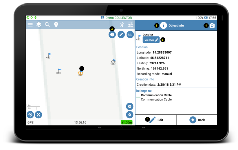
- Select feature on the map.
- Click the Info button
 on the upper right of the mapping screen.
 - Object Info list will open and display features metadata.
- Click the camera icon
 to attach pictures of the feature.
 - Click on the category editor
 to move features to another category.
 - Click the Edit button to edit features custom attributes, that can be configured initially from the Feature Classes page on Geolantis.360 web portal.